Calibrating Floor Maps in AirMagnet Survey PRO
Short answer
C Calibrate the dimensions on the floor map to establish scale before results appear properly.
Question
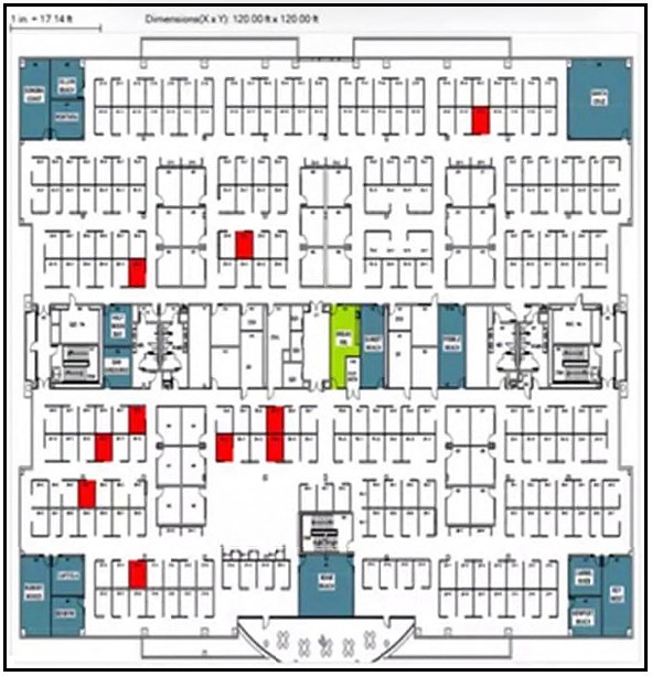
A wireless consultant is performing an onsite survey using AirMagnet Survey PRO.
What must be configured on the floor map so that the results appear properly?
Key Takeaways
Tests the understanding that geometric scale calibration is a mandatory prerequisite for RF visualization in wireless survey software.
Learn why calibrating dimensions is the critical first step in AirMagnet Survey PRO to ensure accurate RF results and proper scaling of floor maps.
Common mistake: Candidates often select 'Add inter-floor bleed' thinking it's essential for multi-floor accuracy, but without dimension calibration, the tool lacks the basic scale needed to render any results correctly.
Expert Analysis
The core concept here is the prerequisite step for accurate radio frequency (RF) modeling in wireless survey tools. Before any signal propagation analysis or heat map generation can occur, the software must understand the physical scale of the environment.
Calibrating Dimensions (Option C) This is the correct action. In AirMagnet Survey PRO and similar Wi-Fi planning tools, you must first define the scale of the floor plan by setting a known reference distance (e.g., marking two points on the image that represent a specific real-world length). Without this calibration, the tool cannot calculate path loss, coverage areas, or antenna radiation patterns accurately because it does not know how many meters or feet correspond to a pixel or inch on the map. As noted in community feedback, "scaling the dimensions" is always the first step when creating a project in Wi-Fi analysis software.
Why other options are incorrect:
- Add inter-floor bleed (Option A): This feature allows RF signals to propagate between floors based on material attenuation settings. While important for multi-story surveys, it requires a calibrated map as a foundation; you cannot configure bleed effects meaningfully if the vertical distances are undefined.
- Show details of user density (Option B): User density is a parameter used for capacity planning or predictive modeling, not a geometric requirement for displaying signal results on a map.
- Display details of desk numbers (Option D): This is purely aesthetic or organizational metadata. It has no impact on the RF physics or the appearance of signal strength results.
The boundary to recognize is between geometric setup (calibration) and content overlay (density/desk numbers). Calibration is foundational; everything else depends on it.
Exam Strategy
When answering questions about wireless survey software configuration, always look for the 'foundational' or 'prerequisite' step. If an option relates to defining the physical space (scale, dimensions, units) versus adding data layers (users, devices, labels), the physical definition almost always comes first. Tools like Ekahau and AirMagnet require scale validation before any physics calculations can proceed.
Frequently Asked Questions
Why is calibrating dimensions necessary in AirMagnet?
Can I perform a site survey without calibrating the map?
Community Votes
74% of anonymous learners picked answer C. Votes are pick records left by other test-takers — they are not the verified answer.
Discussion 1 contributions
Compiled from public community threads and reader submissions, lightly edited for clarity. Handles and vote tallies are shown as recorded, and comments reflect the views of individual contributors.
From public community threads 1
-
Juancho386 👍 1 Answered CEscalar las dimensiones siempre es lo primero que se hace cuando se crea un proyecto en un software de análisis WiFi, tanto para Survey como para Planning
Reader comments & corrections
No reader corrections yet — spotted an error or have a note? Share it below.
Related Analysis
Practice All 300-110 Questions
Access 130 questions with complete answers and detailed explanations.
View Full 300-110 Practice Test →